Having spent a large part of the summer in the Queenstown region we decided to explore The Nevis – New Zealand’s highest public road.

The gravel road takes you to Duffers Saddle, the highest point of the road.
I was a little nervous, as I hate scary roads, but secretly wanted to do it. The thought of driving up the Remarkable ski field road makes me anxious, with sheer drops and no barriers. So a rugged road, with tight corners, possible oncoming traffic reeked of danger to me.
This classic piece of New Zealand road is only open in the summer for 4wd vehicles as it’s snow-bound in winter. The valley can be accessed from Bannockburn, just outside of Cromwell or Garston, near Kingston at the southern end of Lake Wakatipu.

Which ever way you start The Nevis, make sure you allow time for a meal at the legendary Bannockburn pub, the food is fabulous.
The Nevis Road from Bannockburn to Garston is approximately 70 kilometres. If you plan to drive the full 70 kilometres it requires a perfect day as there are a lot of river and stream crossings to negotiate. It’s also advisable to go in convoy with other vehicles as there is no cell phone coverage.
We knew our limitations so planned to only go part way, up and over Duffers Saddle at 1300 metres above sea level. Whilst our Q7 Audi is a 4wd it would not be high enough to negotiate some of the waterways. But that did not stop our enthusiasm. Heading into the valley from Bannockburn, we climbed to the Duffers Saddle, all the way sniffing the warm quiche we had in the back for lunch.
While the road was winding, it was very driveable. I can see how it could lull the ill-informed into a false sense of security as the first part is not even scary. However, it gets a lot more challenging the further you get into the valley.

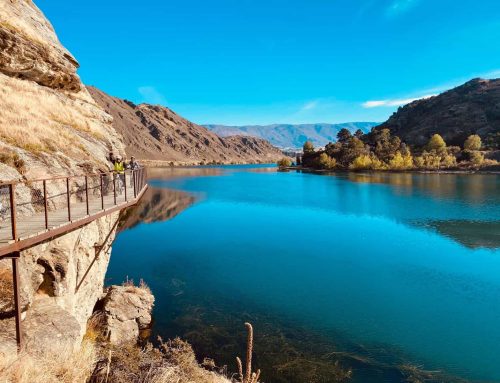
The valley is harsh, yet beautiful.
As we drove higher the landscape changed from farmland, to alpine scrub, to a kind of moonscape. The soil was spartan with huge boulders. The views from Duffers Saddle were truly spectacular, flanked to the west by the glaciated Remarkable Mountains and to the east by the Old Woman Range. So incredible, “The Nevis” has been designated an Outstanding Landscape of National importance.

Enjoying the unusual landscape.

Massive boulders surround Duffers Saddle.
Having reached the top, there is a signpost showing the direction of Aoraki (Mount Cook), some 200 kilometres away. It is visible on a good day. From Duffers Saddle, the road winds down to the Nevis Crossing, a beautiful spot for a picnic and a swim.

New Zealand’s highest public road – The Nevis.
Unpacking the table and chairs we set up our picnic by the side of the Nevis River. Not only is it a great picnicking spot, it’s great fly-fishing water. It’s a small to moderate sized river where the water is very cold and generally clear enough to spot trout. While fish numbers are not high, the size and quality of the fish are good.
After lunch we ventured along the valley floor a little further looking at some of the gold mining relics.

Remains from the gold miners in the 1800s.
The remoteness of this valley has helped preserve the numerous stone buildings from the gold mining and early farming days. They offer a fascinating insight into the perseverance and ingenuity of early pioneers. The relics include a cemetery, settlement buildings, woolshed and the first ski hut.

Ben Nevis Station.
The valley was originally used as a trail route by earlier Maori. Then, in the 1860’s early European settlers farmed the valley. Soon after miners from the Dunstan goldfield discovered gold, causing the Nevis Valley Gold Rush.
Today, the Nevis Valley is a working high country farm. Ben Nevis Station, together with the neighbouring Craig Roy Station totals 20,000 acres and farms over 6,000 sheep and cattle. It is possible to stay at Ben Nevis Station, in luxury accommodation and experience this unique location, its beauty and tranquillity.

I’m not finished with the Nevis yet. Having had a peak, I would like to travel the full valley floor and truly experience the remoteness of this stunning piece of New Zealand, in a real 4wd with an experienced driver!
.


I e been twice , Del was our guide. Did you see the Aussie water wheel? Impressive. And the cute little cemetery?
It’s a special part of NZ
Yes, I agree it’s very special. We saw the little cemetery, but not the Aussie water wheel. Where was it?
Looks amazing Jane – quite an adventure! Penny
A very belated reply,Penny. It was quite the adventure.
The Australian water wheel is near Bannockburn on a Carrick side road – google for details ????
This is not the highest public road that is not a skifield road. Island Saddle is at 1347M.
https://en.wikipedia.org/wiki/Island_Saddle
Thanks for the correction,
I’m keen to see how far my Amarok will take me on 21 or 22 December. Anyone want to convoy with me? 0274 402 105
Sorry for the late response, but how did you get on in driving your Amarok in the Nevis?